
Measuring a plot accurately is critical before any construction, sale or property purchase project.You need to know the exact dimensions to avoid costly mistakes and ensure that your plans work in practice. This practical guide shows you the best methods to make this measurement safely and efficiently.
Land measurement can be done in a variety of ways, from traditional techniques to modern high-tech equipment.You can choose the most suitable method according to the size of the plot, the available budget and the level of precision required for your specific project.Each approach has its advantages and limitations that you must understand before you start.
Why Measure a Land Properly
Proper measurement of a plot of land avoids unpleasant surprises during construction or renovation. You may find that space is not enough for your home, garage or planned commercial project, causing delays and extra costs. An incorrect measurement also compromises the calculations of the amount of materials needed and the total budget of the work.
In addition, you need accurate measurements for legal and registry purposes.Public bodies and banks require correct technical documentation before approving projects, real estate credits or purchase and sale transactions.Imprecision at this stage can result in legal problems, delays in proceedings and even impossibility to sell the property later.
When you are comparing land prices in the market, the exact footage determines the value per square meter and the viability of the investment. A land that looks expensive can actually be a great opportunity if the actual footage is larger than advertised.
Comparison Between Key Measuring Methods
There are five main methods for measuring a plot, each with distinct characteristics that you should consider. The proper method depends on the size of the property, the accessibility of the site, the available budget and the accuracy required by the project. Knowing the differences allows you to choose the option that best meets your specific needs.
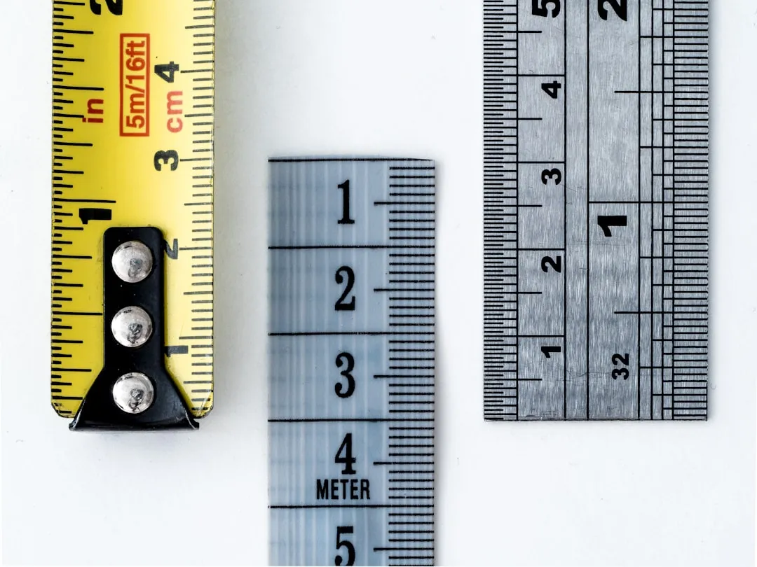
The manual method with a tape measure is the most economical and affordable for small properties and with regular format. You only need a tape measure, notes and time to measure all dimensions. This method works well on plots up to 500 square meters, but can generate errors if not executed carefully and patiently.
The measurement with portable GPS offers greater precision than the manual tape and allows you to map larger terrains and with irregular shapes. You walk through the perimeter of the terrain with the equipment, which records the coordinates automatically and calculates the total area. The cost is moderate, between three hundred and a thousand reais, depending on the quality of the equipment.
The method with theodolite is professional and offers very high precision for complex terrain in urban areas. You hire a surveyor who assembles the equipment at strategic points and performs angular and distance measurements simultaneously. This method is ideal when you need technical documentation for legal purposes or large projects, but costs between one thousand and three thousand reais depending on the footage.
Aerial drone measurement is revolutionary and allows you to view the terrain in three dimensions with centimeter accuracy.You can map properties of any size, even large rural areas, in a matter of minutes.The investment is similar to theodolite, between one thousand and five thousand reais, but offers complete visual documentation that is impossible to obtain with other methods.
Satellite survey is the most technically advanced method and suitable only for large-scale land in rural areas or government projects. You access accurate data from Google Earth Pro or specialized software, combined with reference points on the ground. This method has low initial cost if you use free tools, but requires specialized interpretation of the data.
Manual Measurement with Trena: Step by Step
Manual measurement is the most direct way to know the dimensions of your terrain without relying on expensive technology. You start by gathering the necessary materials: a tape of at least 50 meters, notebook or paper for notes, pencils, wooden pickets or plastic bottles to score points, and a calculator. Arrange everything before leaving home so as not to waste time during the measurement.
The first step is to identify and mark the vertices of the terrain, which are the points of change of direction at the boundaries of the property. You place a picket at each vertex, starting from the front left corner and going clockwise until you return to the starting point. If the terrain has irregular shape with many vertices, mark all of them to ensure accurate measurements.
Now you start measuring each side of the terrain between consecutive vertices, always keeping the tapered well stretched at ground level. Write down each measurement accurately, including centimeters and not just meters. If the terrain has obstacles such as trees or fences in the way, you can measure by skirting or subtracting the dimensions, but always write down the method used for each segment.
When you have finished all the linear measurements, calculate the area using the appropriate formula for the shape of the terrain. For rectangular or square plots, you simply multiply length by width. If the plot is a triangle, multiply base by height and divide by two. For more complex shapes, divide the plot into simple geometric shapes, calculate the area of each separately, and then add it all up.
An important tip is to take the measurement twice to check if the results match exactly. If there is a difference, you identify which segment was measured incorrectly and retake that measurement more carefully. This double-check procedure significantly reduces the chance of error and increases your confidence in the final results.
Measurement with GPS and Portable Technology
Portable GPS receivers have revolutionized the way owners and professionals measure terrain without the need for expensive topographic equipment. You activate the device, allow it to capture the satellite signal for a few minutes for calibration, and then walk along the perimeter of the terrain. The equipment automatically records its position at each step and draws a map of the area.
The accuracy of portable GPS varies between two and five meters, depending on the quality of the equipment and the signal conditions where you are. You get better accuracy in open areas, away from tall buildings and power cables that can interfere with the signal. If the terrain is surrounded by buildings, the accuracy decreases, so this method is not recommended for measurements in very dense urban centers.
The great advantage is that you can measure very large plots, up to hundreds of hectares, in less than an hour of work. You also get a digital file with the exact coordinates, which you can transfer to computer and process into mapping software.
When you are choosing a portable GPS, look for models that offer accuracy of at least two meters and multi-point storage capacity. Known brands like Garmin and Trimble offer reliable equipment at affordable prices for owners. Some models even allow integration with smartphones, making the operation more intuitive and familiar.
Hiring a Professional Topographer
When you need official technical documentation or are measuring very complex terrain, hiring a surveyor is the right choice.The professional has specialized training, calibrated equipment and knowledge of Brazilian technical standards for land survey. He can generate documents accepted by public agencies, banks and notaries without question.
The surveyor begins by visiting the terrain to assess its size, shape, accessibility and site conditions.It identifies whether there are significant obstacles, sharp height differences or special features that affect the measurement. This initial assessment determines which equipment it will use and how long the work will take, which influences the final budget.
During the survey, the professional mounts a theodolite or total station at strategic points of the terrain. He makes precise angular measurements between different points and calculates the distances using trigonometry and laser equipment. All work is recorded in technical notebook, creating a detailed history of how the measurement was performed.
The end result is a professional topographic plant that you can use in various contexts. You get documentation to register in the registry office, for sale or purchase purposes, for construction projects, or for consultations with public agencies. The surveyor also calculates the total area with centimeter accuracy and identifies any irregularity in the partitions with neighboring properties.
The cost of a survey varies greatly according to the region, size of the land and complexity of the work. On average, you pay between one thousand and three thousand reais in urban centers, and less in smaller cities. For very large rural land or with difficult accessibility, the price may be higher, but the investment is justified by the accuracy and documentation obtained.
Using Drones for Air Mapping
Drones have revolutionized terrain mapping by allowing full top-down view of the property with stunning accuracy.You hire a specialized operator who flies over the terrain with a drone equipped with high-resolution camera and altitude sensors.The equipment captures images and distance data that are processed in software to create three-dimensional maps.
The accuracy of a drone mapping can reach five centimeters, depending on the model of the aircraft and the flight altitude. You get not only the footage, but also complete visual documentation, aerial photographs in very high resolution, and even interactive 3D models of the terrain. This is particularly valuable if you are planning complex constructions or wanting to impress customers with professional presentations.
Working time is much shorter compared to traditional methods, since a plot of several hectares can be completely mapped in fifteen to thirty minutes of flight. You also avoid the need to enter dangerous or hard-to-reach terrain, as the drone reaches any point visually from the air. The final file is delivered in digital format, allowing you to take additional measurements later without having to return to the site.
When you are looking to hire a drone mapping service, make sure the operator has the appropriate National Civil Aviation Agency license and insurance. Check the portfolio of previous work to assess the quality of the provided mapping. Request the file in a format that you can open and interpret, such as georeferenced images or 3D models in standard formats.
Free Digital Tools and Software
If you want a quick and free solution, Google Earth Pro allows you to measure terrain using satellites and aerial images. You locate the terrain on the map, activate the measurement tool and draw the perimeter of the property by clicking on each vertex. The software automatically calculates the total area in seconds.
The accuracy of Google Earth varies according to the quality and date of satellite images of the region, and may have an error of two to ten meters. For properties in rural areas with recent images, the accuracy is generally good. However, in urban centers with tall buildings or areas with outdated images, the results may be inaccurate.
Another popular free software is Qgis, which is more complex but offers professional geospatial analysis capabilities.You need to have basic technical knowledge to use but can work with data from multiple sources simultaneously. This program is ideal if you are planning more detailed analysis or comparison of multiple properties.
Smartphone apps like Measure or Terrain Map also offer fast land measurement using the camera and mobile sensors.The accuracy is lower than previous methods, between five and twenty meters, but it serves for quick estimates when you are visiting the terrain.
Treating Land with Irregular Format
Land with irregular shapes is challenging to measure, but you get accurate results by dividing the area into simple geometric shapes.If the terrain has an L shape, you divide it into two rectangles, measure each separately, and sum the areas. This method works for any shape, as long as you correctly identify the geometries involved.
Another technique is to use triangulation, where you divide the terrain into several triangles and calculate the area of each. You mark an internal reference point and measure the distances from this point to all the vertices of the terrain. Then, using the triangles formulas, you calculate the area of each one and sum everything to get the total area.
For very complex terrain with many vertices or irregular curves, GPS or drone are the best options, as they can capture all the details automatically. The surveyor is also used to dealing with any form of terrain and can measure accurately regardless of the geometric complexity of the property.
Height Differences and Sloping Grounds
You need to take into account height differences when the terrain is not completely flat.If the property is on a slope or has significant altitude variation, the horizontal footage is different from the actual surface footage.For construction purposes, you usually use horizontal projection, but for ecological or environmental purposes, the actual surface area matters.
When you are using a tape measure on sloping ground, place the tape measure at surface level, not body height. If there is a large slope, measure in smaller stretches and consider the height of the slope. For accurate measurements on very rough terrain, hire a surveyor who has equipment to compensate for height differences automatically.
The unevenness also affects the calculation of the final area, especially if the terrain has very steep slopes. A plot that appears to have one hundred square meters on the map may have one hundred and twenty in actual surface area if it is very sloping. This difference is important to consider for building materials budgets that need to cover the entire surface.
Documenting and Recording Your Measurements
Always write down your measurements clearly and neatly during the process, don't rely on memory alone. Use a specific notebook or form with fields for each dimension, measurement date, weather conditions, and any relevant observation.
If you are planning to use the data for legal or construction purposes, create a schematic drawing of the plot with all dimensions noted. Include the location of permanent elements such as trees, fences, streams or nearby buildings that serve as a reference. This facilitates further verification and proves that you have taken the measurement carefully and attentively.
Save all original measurement vouchers indefinitely, as you may need them to resolve disputes over property limits. If you have hired a professional, request scanned copy of all technical documentation produced. Organize everything in a physical and digital folder for easy location when needed.
Choosing the Best Method For Your Situation
Choosing the right method depends on several factors that you should carefully evaluate. If the terrain is small, regular and you just want to confirm the footage for sale, manual measurement with a tape measure is enough and saves money.If you are building and need official technical documentation, hire a surveyor from the beginning to avoid rework.
For large or very uneven terrain, portable GPS offers the best balance between cost, accuracy and efficiency. You get reliable data without spending too much and can map any size of property easily.If you want to impress customers or do detailed future analysis, the investment in drone mapping is justified by superior visual quality.
Always consider the ultimate purpose of measurement before choosing the method.For legal purposes and notary, only licensed surveyors offer accepted documentation.For private sale among known persons, careful manual measurement is acceptable.For professional construction projects, you should use topographer or drone to have reliable documentation that supports budgets and schedules.
If you are in doubt, ask for recommendations to local professionals working with real estate or construction. They know the best practices in the region and can indicate the best cost-benefit for your specific situation. Never skimp on this step, as measurement errors cost much more expensive later when you discover problems during construction or sale.
Common Mistakes to Avoid in Measurement
The most frequent mistake is not to check the measurement twice before making important calculations or decisions. Many people measure once, make the calculation of the area, and only then find out that they have made a mistake. Always measure each dimension again before finalizing and compare the results of the two measurements.
Another mistake is to ignore small details that affect the actual shape of the terrain, such as walls built at non-perpendicular angles or large trees that take up space. You need to measure considering these obstacles and decide whether they are inside or outside the terrain as per the official boundaries.Do not assume that the terrain is perfectly square or rectangular without checking.
Using improper tools also causes significant problems, such as trying to measure with too short or old tape that does not provide reliable measurements. Always use equipment in good condition, checking that the tape is not worn or marked incorrectly. If you use GPS or software, validate the results with punctual manual measurements to confirm accuracy.
Not relying on existing measures without personal verification is another frequent mistake, especially when buying properties. The seller may have old, incorrect or purposely exaggerated measurements to inflate the price. Always make your own measurement as confirmation before making any financial decision on the property.